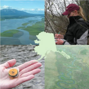
Through a grant from the US Fish and Wildlife Service on behalf of the Western Alaska Landscape Conservation Cooperative (WALCC), we have developed a comprehensive statewide inventory of current and historic continuous monitoring locations for stream and lake temperature. The inventory includes over 2000 unique stream and lake temperature monitoring locations across the state from over forty separate data sources in a standardized, searchable format. The dataset provides a common platform for aquatic ecologists, fish biologists, and climate scientists to share their field sites and discover the monitoring efforts of others. ACCS continues to receive requests from data collectors seeking to be included in the AKOATS inventory. Many of the submissions are from Alaska Native tribal groups which have a unique ability to collect these critical data due to their location, but without AKOATS they lack a means to disseminate their data.
AKOATS Mapping Application
The AKOATS Mapping Application is an ArcGIS online web mapping application allowing users to view AKOATS data and research compiled across the state of Alaska
Click Upload Data to download the AKOATS Data Submission Sheet and instructions on how to use the resource
This project is one component of the LCC’s strategy to help partners understand and prepare for potential climate impacts to freshwater systems across Alaska. This project compiled a statewide catalog of monitoring locations using a common set of attributes. The inventory is fully accessible via an online mapping interface or it can be viewed and queried directly within commercial GIS software. Ongoing projects are gathering the aquatic temperature measurement data and making those data available via this site.
Alaska’s collection of stream and lake temperature monitoring sensors is quite young and rather sparsely arrayed across the vast state. The initial AKOATS inventory identified only 95 actively monitored stream sites with five or more years of continuous data and only 18 actively monitored lakes with five or more years of continuous data. Many of these sites are concentrated in relatively small focal research areas. A little more than half (54%) of Alaska’s 157 sub basins had any documented, continuous aquatic temperature data.
While Alaska’s size and access challenges have hampered past monitoring efforts, numerous ongoing projects offer promising opportunities to develop a robust temperature monitoring network. This inventory provides a statewide catalog of historic and ongoing monitoring, creating awareness across administrative and hydrographic boundaries. AKOATS also provides an easily accessible means for scientists to share new site locations. Related work guided and funded by the Western Alaska Landscape Conservation Cooperative included: piloting regional monitoring networks in Bristol Bay and the Kodiak Archipelago, developing Alaska specific temperature monitoring standards, and plans to convene water resource experts to discuss possible mechanisms to increase data discovery and sharing among partners.
Additional information, data products, and project reports about the AKOATS program can be found on the AKOATS data portal

